Day 5 . Chame – Humde, 35 kms , 840m ascent
Day 6. Humde – Manang, 10 kms, 120m ascent
Day 7. Acclimitisation day at Manang – 700m ascent and descent.
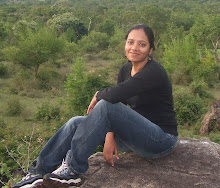
 After the initial hot and sweaty days, the climate now was comparatively cool and breezy. The sun was brighter and harsher, and sun-glasses and sun-screen lotion became a necessity.
We walked through small forests and shared narrow trails with mules, which are used to carry supplies up and down the mountains.
Trail of Trekkers!
At the end of day 4 we reached Chame and were shocked to see that most of the hotels were full and the place was thronging with trekkers. Until now we were a bit behind schedule and didn’t stay in the villages recommended by Lonely Planet. Now for the 1st time we encountered the throng of trekkers and were taken aback by the sheer numbers.
Next day morning when we started the trek, instead of seeing the trail we only saw one long line of trekkers. Trekkers ahead, trekkers behind and pretty much everywhere! So we decided to ‘get lonely’ by not stopping at Pisang (as recommended in the guide) but by walking further and going upto Humde (which we later realized was an extra 15 km walk!)

After a trek through a forest we came upon a dramatic curved slab of rock rising 1500m from the river. A level trail through pine trees and a small lake surrounded by huge snow capped mountains (Annapurna II and Pisang Peak
While most of the trekkers halted there we continued toclimb over a forested ridge where from the top we could see a whole range of snow-capped mountains and the beautiful Manang valley below.
My favourite village in the Annapurna..
15 kms later we were at Hungde, where the landscape was filled with buck-wheat fields with their pretty pink flowers and the air full of musical notes from the bells tied around sheep, horses, cows and yaks which were grazing lazily. This is the closest I felt to being in the Swiss Alps. Right at that point, on day 6 of our trek, I had already made up my mind that this was going to be my favourite village the Annapurna Region. Good news for non-trekkers – There is an air-strip to get here directly!
Modern Manang!
The trail from Hungde to Manang was easy and offered a spectacular view of huge snow-capped mountains (Annapurna III, IV and Tilicho Peak


Mithoo had old us about Manang having some good hotels and so we hurried to find the best accommodation. After a short-walk (hardly 10 kms) along the Matsyangdi flanked by barley and buckwheat fields on either side we reached the modern village of Manang
Given that it was only 10.30 a.m when we checked in to the hotel, we started asking people around for suggestions on local treks.


Glacier View Point –
We climbed up a steep, narrow trail overlooking a turquoise greenish-blue lake that was formed by a melting glacier from the Gangapurna mountain. After a 30 minute walk, the trail joined another easier trail that took us up to the Glacier view point.
From the top, the view of Manang was beautiful! We bought some Yak cheese at the tea-shop on top and tapped our feet to our favorite song from Rock On that was playing on the radio!
Frozen Lake Trip-
The next day also we had to stay at Manang compulsorily for acclimatization. The rule of acclimatization being ‘Walk high sleep low’, we decided to make a trip to the frozen lake at 4400 Mtrs to acclimatize better.
Initially we found it hard to find the route to the lake. After walking over thorns and walking in circles we almost gave up. Suddenly we saw 2 trekkers walking on a hill above us. We followed their direction and soon saw an ACAP board with an arrow sign. We climbed 700 Mtrs and as we ascended the views around us were stunning. After more than 3 hours of steep climbing we gave up when we found out that the lake was still an hour’s walk away. It was 2 p.m and the winds had already started.
After a small picnic of bread, jam and yak cheese we started our descend. We did not realize when we climbed up how steep the trail had been. Now climbing down was getting challenging. The small gravel like stones made it very slippery. We had only one trekking pole each and sorely missed the luxury of having two poles each while descending. There were certain points where the trail was narrow and slippery with a huge fall on the other side and here I would freeze with panic unable to go neither forward nor backward. Harsha would then give me a hand and pull me safely to the other side.
Flying Dutchman teaches a life saving technique!
The previous day while on a trip to a Gompa (Monastery) Harsha faced a similar problem while coming down. Here he met a Dutch fitness instructor, whom he affectionately referred to as the flying Dutchman, who taught him a technique that will ensure that you don’t fall off while on a narrow slippery trail.
If the fall is on one's left side (and the mountain to your right), then one should lean toward the left (counter-intuitive but life saving) and put pressure on one's left hip, this will help one balance. Instead, if you put pressure on your right you increase the chances of falling. Skiing -101 behind us, we continued and were happy to finally reach the hotel.
No comments:
Post a Comment